Varthur Road to Whitefield Distance

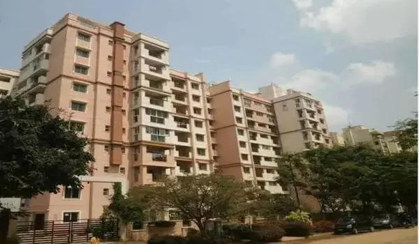
Featured Image of Varthur Road to Whitefield Distance


The Varthur Road to Whitefield distance is around 7 km via the main State Highway 35 route. The distance between Varthur Road and Whitefield can be around 5 to 9 km. It depends on where you start and where you want to go in Whitefield. By car or bike, it usually takes 15 to 25 minutes in normal traffic. During busy office hours, the travel time can be longer. Varthur Road and Whitefield are well-known areas in East Bangalore, with many IT offices, homes, schools, shops, and other daily facilities. Their close distance makes it a convenient route for office workers, students, families, and homebuyers. If you want to buy a home with quick access to top workspaces, Prestige Ivy Green is a great choice because it sits right along Varthur Main Road, close to the major tech hubs. This short road route links two primary IT zones in East Bangalore. Thousands of tech workers, students, and families travel this path every single day. The actual travel time depends heavily on the hour you choose to drive. Public buses, auto-rickshaws, and private cabs are always available here. New infrastructure projects will make this daily travel even faster soon.


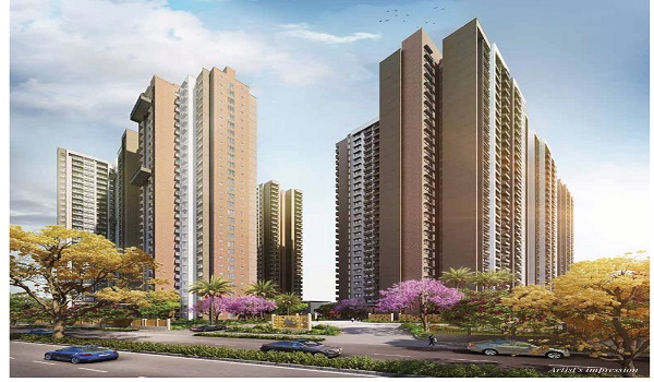
Prestige Ivy Green: A Prime Residential Choice


Prestige Ivy Green is a new residential project on Varthur Road, Whitefield. It offers easy access to Whitefield and other parts of East Bangalore. The project is planned to launch in January 2027, with possession expected by December 2030. The RERA registration is in process, and approval is still pending.

The project is close to major offices, schools, and hospitals. Its location can help residents save travel time and avoid long daily drives. This makes Prestige Ivy Green a good option for homebuyers looking for a home in the Varthur Road area.

Important Places Between Varthur Road and Whitefield


The route between Varthur Road and Whitefield passes through several important residential and commercial areas. Some of the commonly known locations around this corridor include:

  • Varthur Lake Junction
  • Gunjur Main Road
  • KK English School Corridor
  • Columbia Asia Hospital (Manipal Hospital Varthur)
  • Nexus Value Forum Mall
  • Hope Farm Junction
  • Kadugodi
  • ITPL Main Road

These areas have developed quickly because of the presence of IT companies, business parks, shopping centres, schools, hospitals and residential communities.

Varthur Road to Whitefield Distance by Road


The Varthur Road to Whitefield distance by road is around 7 km when you travel through State Highway 35 (SH-35). The exact distance may be between 5 km and 9 km, depending on your starting point and final destination in Whitefield. By car or two-wheeler, the journey is usually easy when the roads are less busy. During peak office hours, traffic can be heavy so that travel time may increase. This route is commonly used by people travelling between Varthur, Gunjur, Hope Farm, and Whitefield for work and daily needs. Heavy traffic can slow you down between 8:30 AM and 10:30 AM. It is smart to check live maps before you start your trip. The roads are wide and well-lit for safe night driving.

Travel Time and Best Route Options


The average travel time on this road stretch is 20 minutes when traffic is light. However, busy office hours can increase this time up to 45 minutes. The best route goes over Varthur Main Road / SH-35 and passes straight through to Hope Farm Junction. It then goes through Kadugodi to hit the center of Whitefield.

During peak office hours, the journey can take considerably longer. The Varthur Lake Junction, Gunjur area, SH-35 stretch and nearby junctions can experience heavy traffic. This is especially common when large numbers of employees travel between residential areas and IT offices.

For this reason, people who travel daily between Varthur Road and Whitefield usually keep extra time during weekday mornings and evenings. A journey that takes around 20 minutes in lighter traffic may take much longer during busy hours.

Varthur Road to Whitefield by Car


Travelling by car is a convenient choice for families and office workers who prefer direct travel. The distance between Varthur Road and Whitefield is not very long, so the journey can be comfortable when traffic is low. A car also gives you more flexibility, as you can start your trip at any time and reach your exact destination without changing vehicles. The main problem is traffic. Varthur Road is an important arterial road connecting Sarjapur Road with several parts of Whitefield. Whitefield is also a major business and residential area. Because of this, roads between the two locations can become busy during office hours.

Varthur Road to Whitefield by Bike


A bike or scooter can be a practical choice for people who travel alone every day. Since the road distance is only around 7 km on a commonly used route, two-wheelers can be convenient for short daily commutes.

The travel time can still change because of traffic signals, road conditions and congestion. Riders should also check the road situation before starting, especially during rainy weather or when construction work is taking place.

Varthur Road to Whitefield by Bus


BMTC buses connect Varthur Road with different parts of Whitefield and nearby areas. Bus travel can be useful for people who do not want to drive every day.

The exact bus route and travel time depend on the boarding point and destination. Since traffic can affect buses as well, the journey may take longer during peak hours. Passengers can check the latest route and timings before travelling.

Varthur Road to Whitefield Metro Updates


Metro connectivity is an important factor for people living and working in East Bangalore. Whitefield is served by the Purple Line, which connects the Whitefield area with several important parts of Bangalore.

Varthur Road also benefits from nearby metro access along the Hope Farm and Kadugodi stations. Additional light rail and metro corridors are being evaluated to improve public transport access through areas such as Varthur Main Road and towards Sarjapur Road.

This will link both areas for a smooth, stress-free trip. Trains will help you skip all the street traffic completely. It will also reduce air pollution in the local area. Real estate prices near these stations are already rising fast.

Public Transport: Bus Timings and Trains


Buses are easily available from Varthur Road to Whitefield from around 5:30 AM until late at night. BMTC operates regular buses on this route so that people can use them for daily office travel, shopping, and other work. Bus fares are also affordable, with a normal ticket costing around ₹15 to ₹35. This makes bus travel a good option for people who want to travel between Varthur Road and Whitefield without spending much on transport. The nearest railway station to the Varthur Road to Whitefield route is around 7 km away at Whitefield Railway Station. A cab can take about 20 minutes to reach the station, depending on traffic. From there, passengers can take local trains as well as trains to other parts of Bangalore and nearby cities.

Distance to Major IT Parks and Nearby Areas


The Varthur Road to Sigma Tech Park distance is just 4 km via the main SH-35 road. Employees can reach this office in less than 10 minutes by bike. Meanwhile, the distance to International Tech Park Bangalore (ITPL) is about 8 km via Varthur Main Road.

The distance across town to central zones is longer, but living in East Bangalore makes your commute to work much easier. It cuts down on daily fuel costs and saves your energy.

FAQs


1. How far is Whitefield from Varthur Road?

Whitefield is about 7 km away from Varthur Road by road. The drive takes 15 to 25 minutes when traffic is normal.

2. Does Varthur Road come under Whitefield?

No, Varthur Road does not strictly come under Whitefield. They are adjacent, interconnected commercial and residential corridors in East Bangalore.

3. Why is Varthur Road famous?

Varthur Road is famous for its rapid infrastructure growth, proximity to Varthur Lake, and direct connectivity between Sarjapur Road and Whitefield IT hubs.

4. Which metro station is near Varthur Road?

The nearest active metro stations are Hope Farm Channasandra and Kadugodi Tree Park on the Purple Line, located roughly 6 km away.

5. What is the fastest way to travel between these areas?

Riding a two-wheeler is the fastest way during heavy traffic hours. The metro feeder network will also be a top choice once upcoming extensions are complete.

Enquiry
Enquire Now